Skip to content
Somerville Transportation Equity Partnership
  • Home
  • Green Line
  • McGrath Blvd
  • Buses
  • Health Issues
  • Transportation News
  • Background
  • About STEP
  • Toggle website search
Menu Close
  • Home
  • Green Line
  • McGrath Blvd
  • Buses
  • Health Issues
  • Transportation News
  • Background
  • About STEP
  • Toggle website search

Blog

State publishes Community Path map

  • Post published:June 20, 2010
  • Post category:Green Line

Communnity Path map
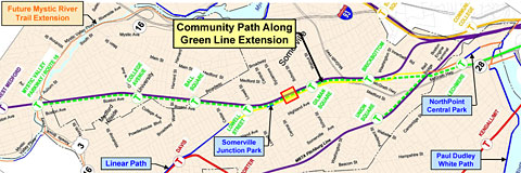
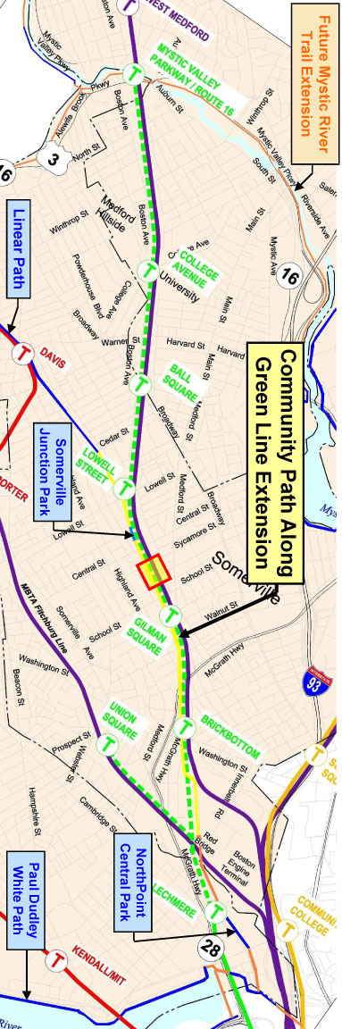
MassDOT created what it calls a “conceptual map” of the Community Path, which is being designed along with the Green Line extension. Click to see a larger version or download the PDF.


Communnity Path map

You Might Also Like

Video segment on Ball and Magoun Squares

October 4, 2009

Community letters support Community Path

December 13, 2011

SIP projects (including Green Line) appear in Federal Register

November 5, 2007

TRANSPORTATION PROJECTS

View a map and summaries of planned and potential projects in Somerville!

GET INVOLVED

You can make a difference! Come to a STEP meeting or join our email list to stay up to date:


FOLLOW STEP

Multiple ways to stay in touch with STEP:
Facebook Facebook
Facebook Twitter
Facebook RSS

Email us at info@somervillestep.org