The Metropolitan Area Planning Council 2007 Calendar features a map with the following text…
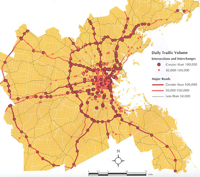
Heavy Traffic Affects Air Quality and Health
If you live, work or attend school within 100 yards of a roadway carrying 100,000 or more vehicles per day, you are more likely to suffer from cardiac or pulmonary disease.
According to local and national studies, this tendency is linked to traffic-related air pollutants. Health risks associated with traffic pollutants are greater for young and old people and for those with permanent health conditions. Some states have begun to pass laws to protect their citizens. California state law restricts the siting of new schools within 500 feet of a freeway or an urban roadway with 50,000 vehicles or more per day. The California Air Resources Board recommends caution before siting residences, day care centers, playgrounds, or medical facilities within those same distances.
This map shows roadways and intersections in the MAPC region that exceed 100,000 vehicles per day and those that exceed 50,000 vehicles per day. The map could help policy-makers formulate measures to protect the state’s most vulnerable citizens.”