Skip to content
Somerville Transportation Equity Partnership
  • Home
  • Green Line
  • McGrath Blvd
  • Buses
  • Health Issues
  • Transportation News
  • Background
  • About STEP
  • Toggle website search
Menu Close
  • Home
  • Green Line
  • McGrath Blvd
  • Buses
  • Health Issues
  • Transportation News
  • Background
  • About STEP
  • Toggle website search

Blog

3D models of Green Line station areas

  • Post published:May 29, 2010
  • Post category:Green Line

College Ave station in Google Earth
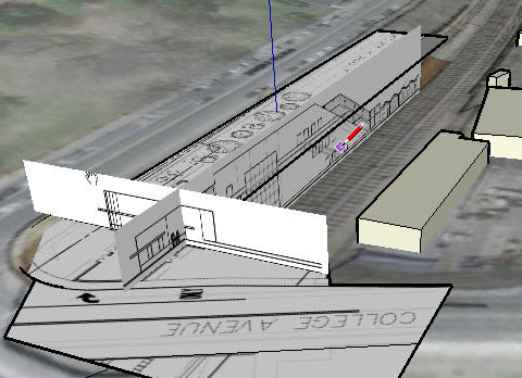
Paul Cote with Harvard’s Graduate School of Design has created a 3D environment using Google Earth to help visualize the station areas and designs. You can download his models and even add your own ideas in 3D. Check it out.

You Might Also Like

Responses to anti-Green Line article

May 3, 2005

Maps of some Green Line options

October 21, 2004

Boston Globe: Transportation report delayed

April 23, 2006

TRANSPORTATION PROJECTS

View a map and summaries of planned and potential projects in Somerville!

GET INVOLVED

You can make a difference! Come to a STEP meeting or join our email list to stay up to date:


FOLLOW STEP

Multiple ways to stay in touch with STEP:
Facebook Facebook
Facebook Twitter
Facebook RSS

Email us at info@somervillestep.org